At Best Cosmetic Hospitals, we believe that achieving your aesthetic goals should be an empowering and enjoyable journey. That's why we connect you with the world’s top destinations for cosmetic surgery, where you can experience not only the highest standards of medical care but also the excitement and beauty of exploring new places. Whether you’re seeking transformative surgery or non-invasive treatments, these destinations offer exceptional hospitals, renowned surgeons, and unique cultural experiences that enhance your cosmetic journey.
Cosmetic surgery has become a global phenomenon, with individuals traveling across borders to find the best hospitals, most experienced surgeons, and competitive prices. In doing so, patients can combine their medical treatments with the opportunity to visit stunning destinations, creating a transformative experience that’s more than just about looks—it's about rejuvenating the body and soul.
The decision to undergo cosmetic surgery abroad is becoming more popular than ever, and for good reason. With top-tier hospitals, experienced surgeons, and affordable prices, medical tourism offers patients the opportunity to receive world-class care while exploring new cultures. Here are some of the key benefits of choosing international destinations for cosmetic surgery:

1. Access to World-Renowned Surgeons: Many destinations around the world are home to leading cosmetic surgeons who are internationally trained and recognized for their expertise. These surgeons use the latest techniques and technologies to deliver stunning, natural-looking results. By traveling abroad, you can benefit from the experience of globally acclaimed doctors who specialize in the procedure you desire.
2. State-of-the-Art Medical Facilities: Top cosmetic surgery destinations feature state-of-the-art hospitals and clinics that adhere to international standards of safety, hygiene, and patient care. Many of these facilities are accredited by global healthcare organizations such as Joint Commission International (JCI), ensuring that you receive the best care in a comfortable and professional environment.
3. Cost-Effective Solutions: One of the primary reasons patients choose to travel for cosmetic surgery is the significant cost savings. Many destinations offer high-quality treatments at a fraction of the cost found in countries like the U.S., the U.K., or Australia, without compromising on safety or results. Patients can enjoy the same level of expertise and care for a much more affordable price, often bundled with travel and recovery packages.
4. Seamless Medical Tourism Packages: Top cosmetic surgery destinations offer comprehensive medical tourism packages that make your journey as seamless as possible. From airport transfers and luxury accommodations to personalized aftercare, these packages are designed to provide a stress-free experience. Many hospitals also provide multilingual support, cultural guidance, and visa assistance, ensuring a smooth and comfortable stay.
5. Combine Treatment with Travel: Choosing an international destination for your cosmetic surgery allows you to experience the beauty and culture of a new country. Whether you're relaxing on a pristine beach in Thailand, exploring historic sites in Turkey, or enjoying the vibrant city life in Mexico, traveling for surgery gives you the chance to combine medical care with a once-in-a-lifetime travel experience.
The world is home to many outstanding destinations for cosmetic surgery, each offering unique advantages, from renowned surgeons to exceptional medical facilities and stunning recovery environments. Here are some of the most popular and highly recommended destinations for those seeking a life-changing cosmetic surgery experience:
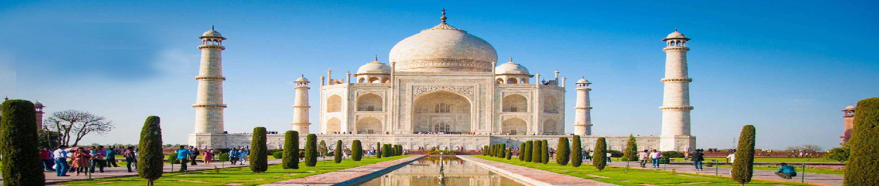
India has emerged as a leading destination for cosmetic surgery, offering highly skilled surgeons, state-of-the-art hospitals, and affordable procedures in cities like Mumbai, Delhi, and Bangalore. India’s healthcare system is renowned for its expertise in procedures such as rhinoplasty, breast augmentation, and liposuction, as well as non-surgical treatments like fillers and Botox.
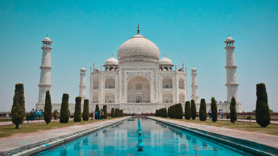
What makes India truly unique is the opportunity to combine your cosmetic surgery with cultural and spiritual experiences. After surgery, patients can explore India’s rich heritage, from the iconic Taj Mahal to the serene landscapes of Kerala. Many patients also choose to integrate wellness practices like yoga and meditation into their recovery, making India a holistic destination for transformation and rejuvenation.
LOCATION : INDIA is located in Asia, the largest continent in the world. This country is set apart from the rest of Asia by the supreme continental wall of the Himalayas in the north, the Bay of Bengal to the east, the Arabian Sea to the west and the India Ocean to the south. India comprises of 28 states and seven union territories. The neighboring countries are Nepal, China, Bangladesh, Bhutan, Burma and Pakistan. Although India occupies only 2.4% of the world's land area, it supports over 1.1 Billion People.
AIRPORT & TRAVEL : Apart from the capital of Delhi, the other major cities are Bangalore, Mumbai, Kolkata Chennai and Kochi. All these cities are well connected by Air, road and Railways. The approximate travel time from New York or Los Angeles to any of these cities are between 14 to 18 hours. There are over 80 airports in India of which 12 are international airports. Domestic and International carriers operate flights to connect all major locations across the world on a daily basis.
LANGUAGES: India is country rich in languages. There are a quite a number of languages spoken in India, some of these languages are accepted nationally while others are accepted as dialects of that particular region. India has 22 officially recognised languages. Hindi, in the official language of the Federal government of India. English is an associate official language. Sanskrit, the classical language of India, may be traced back to Rig Vedic period and is more than 5,000 years old. All the classical literature and the Indian epics have been written in Sanskrit.
There are over 70 Consulates and Embassies that operate in India and are located in the capital Delhi apart from few other major cities across. Foreign nationals coming to India are required to possess a genuine and valid national passport or any other internationally recognized travel document establishing his/her nationality and identity and bearing photograph of the foreigner and a travel visa. There is no provision of "Visa on Arrival" in India.
The currency of India is the Rupee, issued by Reserve Bank of India. The most commonly used symbol for the rupee is 'Rs' and code for the Indian rupee is INR. There are many establishments that are authorized to accept foreign currency, like the US dollar or the Euro. Apart from currencies, 'Credit Cards' and 'Travelers Cheques' are used for certain transactions.
India has been enjoying the status of "Tourist Capital" during the last decade. The history, cultural diversity and the landscape attracted many tourists from across the world.
Highly experienced surgeons and JCI-accredited hospitals that provide top-quality care at affordable prices.
Affordable cosmetic surgery with significant cost savings compared to Western countries.
Cultural and spiritual experiences that allow for a transformative recovery journey, from yoga retreats to ancient landmarks.
India offers a holistic approach to cosmetic surgery, where medical care, cultural enrichment, and spiritual wellness come together to create a truly life-changing experience.
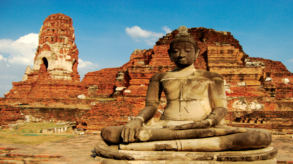
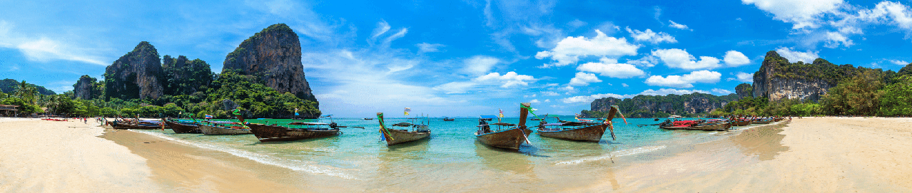
Thailand is one of the world’s most sought-after destinations for cosmetic surgery, attracting thousands of patients each year. With world-class hospitals, internationally trained surgeons, and significantly lower costs than in Western countries, Thailand has become a global hub for medical tourism. Bangkok, Phuket, and Chiang Mai are home to renowned clinics and hospitals offering procedures ranging from facelifts and liposuction to breast augmentation and non-invasive treatments like Botox and fillers.
Beyond the exceptional medical care, Thailand’s natural beauty, luxurious wellness resorts, and tropical climate make it an ideal location for recovery. Patients can relax in serene beachside resorts or retreat to tranquil wellness centers, where they can recuperate in peace and privacy.
LOCATION & GEOGRAPHY:
Thailand is located in Southeast Asia, bordering Myanmar (Burma), Laos, Cambodia and Malaysia, and the Andaman Sea. Thailand is a tropical country with often hot and rainy weather and annual monsoons, with a range of geographic regions - mountainous, plains and plateaus, as well as a number of beach areas.
Thailand is as rich in geographic diversity as it is rich in history and culture. There are few places on earth that offer the visitor so much - jungles and mountains, rivers and countryside, islands and beaches, temples and palaces, cities and technology.
Thailand was for centuries known as 'Siam'. Thailand is a constitutional monarchy with a long democratic tradition-political parties and elections. The current monarch is His Majesty King Bhumibol Adulyadej-the world's longest reigning monarch.
Thailand is a modern country with a thriving economy. Exports include computers, office machine parts, transistors, rubber, motor vehicles, plastic, seafood and rice. Although Thailand is recognized globally as a tourist destination, tourism accounts for only 3.6% of GDP.
Population-65 million, Area-198,115 sq mi (513,115 sq km), Currency-Baht (THB, symbol ?) = 100 Satang, Flight times-New York is a 17 hour flight away, Los Angeles 18 hours and London 12 hours, Cities-Bangkok (capital), Samut Prakan, Nonthaburi, Udon Thani, Nakhon Ratchasima, Time Zone-GMT +7, Weather-Northern and central Thailand have three seasons: hot (March through May), rainy (June through October), and cool (November through February), Southern Thailand has intermittent showers year-round, with daily showers in the rainy season, Thailand's monsoon season generally runs from July into November, Religion-Buddhism (95%), Islam (3.8%), Christianity (0.5%), Hinduism (0.1%), Electricity-220 volts AC, 50Hz, two-pin plugs are standard.
Highly skilled surgeons and JCI-accredited hospitals offering advanced cosmetic surgery techniques.
Affordable procedures compared to Western countries, with significant cost savings.
A serene recovery experience in tropical resorts and wellness retreats in Phuket, Koh Samui, and beyond.
With its combination of expert medical care and stunning recovery settings, Thailand offers the perfect blend of transformation and relaxation.
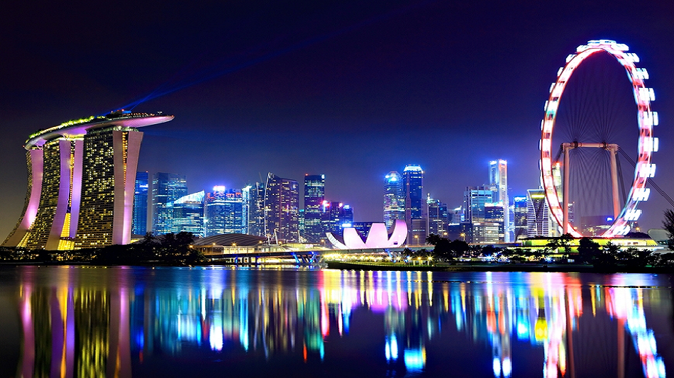
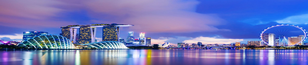
Singapore is globally recognized for its outstanding healthcare system, consistently ranked among the best in the world. With state-of-the-art medical facilities, highly skilled and internationally trained professionals, and a strong emphasis on patient safety and care, Singapore has become a leading destination for cosmetic procedures.
The country’s healthcare infrastructure is backed by cutting-edge technology and stringent regulatory standards, ensuring high-quality and safe treatment outcomes. From non-invasive aesthetic treatments to complex surgeries, Singapore’s hospitals and clinics offer personalized, top-tier care that attracts patients from across the globe. This commitment to excellence makes Singapore a prime destination for those seeking cosmetic enhancements in a safe, modern, and welcoming environment.
LOCATION & GEOGRAPHY:
Located in southeastern Asia, between Malaysia and Indonesia, Singapore is an island nation consisting of the island of Singapore and about 60 smaller islands. It is situated between latitudes 1'09'N and 1'29'N, and longitudes 103'38'E and 104'25'E, about 60 miles (137 kms.) north of the Equator. The main island is about 42km in length and 23 km in breadth and 586.5 sq km in area. It has a coastline of approximately 150.5 km.
Singapore's immediate neighbors are Malaysia to the north and Indonesia to the south. Singapore is linked to Peninsular Malaysia by a 1,056-m-long causeway, which carries a road, a railway and a water pipeline across the Strait of Johore.
From a sleepy fishing village in the early 1900's, Singapore has become one of Asia's leading economies popularly referred to as 'Asian Tigers'. In 1819 Sir Thomas Stamford Raffles landed in Singapore and established a British trading station. Singapore's landscape was transformed by British colonial rule, Japanese occupation, Communist insurrection and finally, independence. Since becoming a republic in 1965, the island has experienced increased prosperity and exponential economic growth. Shimmering skyscrapers tower above the slick financial districts and elegant colonial buildings preserve a lingering old-world charm.
By and large, year-round temperatures in Singapore remain uniform, with a daily average of 81? (27?), afternoon temperatures reaching as high as 87? (31?), and an average sunrise temperature as low as 75? (24?). Relative humidity often exceeds 90% at night and in the early morning. Even on a "dry" afternoon, don't expect it to drop much below 60%.
Population-4.6 million, Area-271.8 sq. mi. (704 sq. km.), Currency- Singapore Dollar (SGD, $) and Cents, Flight times-From UK it takes 14-15 hours, from New York it is an 18 hour flight, Cities-Singapore, Time Zone-GMT +8, Weather-Warm and humid; November and December is the rainy season, Languages-English, Mandarin, Malay and Tamil, Religion-Buddhism-42.5%, No religion-14.8%, Christianity-14.6%, Islam-13.9%, Taoism-8.5%, Hinduism-4%, Other religions-1.6%, Electricity-230V/50Hz (British Plug); power outlets accept only flat three pin plugs.
Highly skilled surgeons and JCI-accredited hospitals offering advanced cosmetic surgery techniques.
Affordable procedures compared to Western countries, with significant cost savings.
Scenic recovery locations in beachside resorts or urban cultural hotspots.
Choosing Singapore means accessing world-class cosmetic treatments in a safe, welcoming, and technologically advanced environment, making it an ideal destination for those seeking the best in aesthetic healthcare.
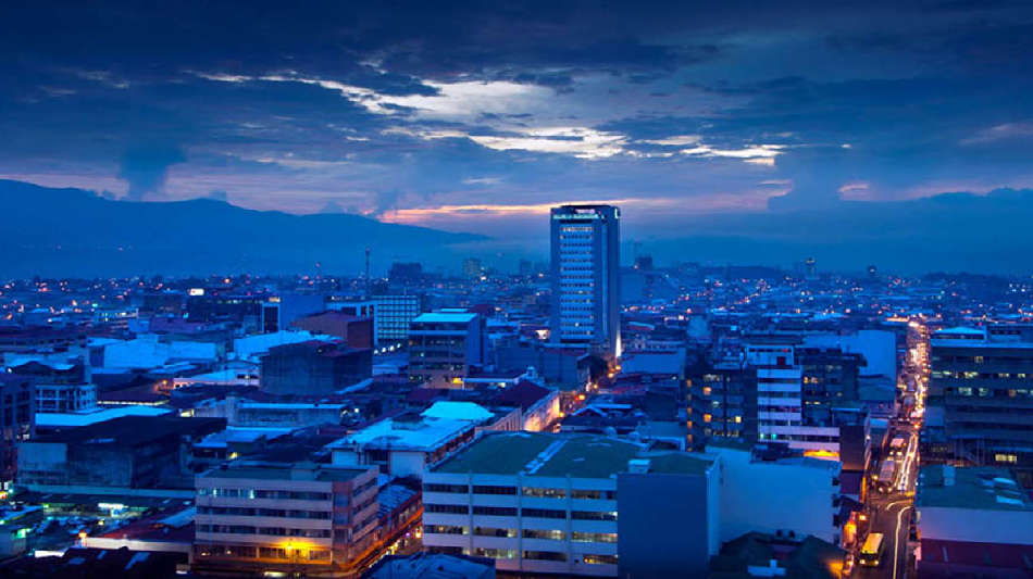
Costa Rica has quickly become a hotspot for medical tourism, offering a blend of world-class medical care and eco-conscious wellness experiences. Known for its stunning natural beauty, Costa Rica attracts patients seeking cosmetic surgery in a peaceful and serene environment. Procedures like facelifts, breast augmentation, and non-invasive treatments are popular among medical tourists who value both high-quality care and sustainability.
In addition to its advanced medical facilities, Costa Rica is home to some of the world’s most beautiful recovery settings. Patients can heal in eco-friendly resorts nestled in the jungle or on pristine beaches, where wellness, sustainability, and relaxation are seamlessly integrated into the post-operative experience.
Costa Rica is the second-smallest Central American nation after El Salvador, and is located in the Central American isthmus, between the Pacific Ocean and the Caribbean Sea. At its narrowest point, in the south, only 119 km separate the Caribbean from the Pacific. Even in the northone can savor a leisurely breakfast on the Caribbean and take an ambling five-hour drive to the Pacific for dinner. At its broadest point, Costa Rica is a mere 280 km wide. On the ruler-straight eastern seaboard, barely 160 km separate the Nicaraguan and Panamanian borders. And while the Pacific coast is longer, it is still only 480 km from the northernmost tip to the Panamanian border as the crow flies.
Its location in Central America, stunning scenery, ideal climate and friendly locals enhance its reputation as a premier eco-tourism destination. Its long coastline means great surfing, beaches galore and a climate built for laziness. Costa Rica's enlightened approach to conservation has ensured that its lush jungles, national parks, wildlife refuges and biological reserves are home to playful monkeys, languid sloths, crocodiles, countless lizards, poison-dart frogs and a mind-boggling assortment of exotic birds, insects and butterflies. Meanwhile, endangered sea turtles nest on both coasts and cloud forests protect elusive birds and jungle cats.
Costa Rica is a tropical country and experiences only two seasons: wet and dry. The dry season is generally between late December and April; the wet season lasts the rest of the year. Temperatures vary little between seasons; the main influence on temperature is altitude. The highlands are cold: San Jose and the Central Valley get an 'eternal spring' with lows averaging 60F (15C) and highs averaging 79F (26C).
Costa Ricans are a fairly mixed group of people. Though the majority of the country's approximately four million inhabitants are descendants of Spanish immigrants, many families originated in other parts of Europe, Asia, Africa and, of course, Central America. In the lowlands, a high percentage of people are "mestizo", possessing a mixture of European and indigenous blood, whereas the majority of inhabitants along the Caribbean coast are of African lineage, and full-blooded Indians of various tribes inhabit much of the Talamanca Mountain Range.
Costa Ricans are polite, hospitable, well-educated and gregarious. They are well aware that their country is a special place, and they go out of their way to accommodate visitors.
Population-4.5 million, Area-19,714 sq mi (51,060 sq km), Currency- Costa Rican Colon (CRC) and Centimos, Flight times-New York is a 5 hour flight away, Los Angeles 11 hours, Miami 2.5 hours and London 12 hours (including stopover time), Cities-San Jose (capital), Alajuela, Cartago, Puntarenas, Puerto Limon, Time Zone-Costa Rica is on UTC or central standard time (same as Chicago and St Louis), which is GMT-6, Costa Rica does not use daylight saving time, so the time difference is an additional hour from April through October. Weather-Tropical, with heavy rains from May to November, Languages-Spanish, English, Religion-Catholic (76%), Electricity-110 volts AC (60 cycles), however three-pronged outlets can be scarce, so it's helpful to bring along an adapter.
Eco-conscious healthcare with a focus on sustainability and holistic recovery.
High-quality cosmetic procedures performed by expert surgeons in modern facilities.
Stunning recovery settings in Costa Rica’s lush rainforests or tranquil beach resorts.
Costa Rica offers a unique experience where medical care and nature come together to provide a tranquil, rejuvenating recovery after your cosmetic surgery.

Mexico has become a top destination for North Americans seeking high-quality cosmetic surgery close to home. Cities like Tijuana, Cancun, and Mexico City are renowned for their exceptional hospitals, experienced surgeons, and cost-effective procedures. From body contouring and breast augmentation to facelifts and non-surgical treatments, Mexico offers a wide range of procedures at a fraction of the cost found in the U.S. or Canada.
Mexico’s proximity to North America makes it especially convenient for patients who want excellent care without traveling too far. The country also boasts beautiful recovery destinations, from the beach resorts of Cancun to the cultural wonders of Mexico City, allowing you to heal in comfort while enjoying Mexico’s hospitality.
Mexico is a land with a vibrant, colorful and unique nature with varied terrain ranging from cactus-studded deserts to the white sandy beaches and blue waters, tropical rainforest and jungle-clad hills to steep rocky canyons and narrow gorges, and from snow-capped volcano peaks to bustling cities. Located in the Central America, bordering the Caribbean Sea and the Gulf of Mexico, between Belize and the US and bordering the North Pacific Ocean, between Guatemala and the US
Since the height of Mayan and Aztec civilizations, Mexico has suffered the destructive force of the conquerors, the European colonial rule, civil and territorial wars, rebellions, dictatorships, recessions and earthquakes. The countryside remains un-spoilt by development, and its cities display a unique style of architecture. The extraordinary history is reflected in the ancient Mayan temples spread across the jungles and ruins of Aztec civilizations, rural indigenous villages, Spanish colonial cities and silver mining towns, and traditional Mexican ports.
Buildings display a unique combination of colonial and pagan architecture, blending together Art Nouveau, Baroque, Art Deco and Native American design into the structure of their churches and public structures. The country's culture displays a similar blend of the traditional and modern, where pagan meets Christian in a series of festivals, or fiestas throughout the year.
Language in Mexico
Spanish is the official language. As many as 100 Native American languages are still spoken in Mexico, but no single alternative language prevails. Eighty percent of those Mexicans who speak an indigenous language also speak Spanish. The most important of the Native American languages is Nahuatl. It is the primary language of more than a million Mexicans and is spoken by nearly one-fourth of all Native Americans in the country
Mexico's Capital City, often referred to as just "Mexico" by people living in the country, and is one of the world's most populated areas with an estimated 22 million inhabitants living inside an area of 750 square kilometers.
Mexico City is situated over 2,250 meters (7,400 feet) above sea level and watched over by two mighty volcanoes. It is one of the oldest cities in the world. Originally a "floating city", served by a large and complex network of canals when it was the epicenter of the Aztec empire; today, the nation's capital is one of the world's most populous mega-cities on our planet.
A restored ruin of the most important temple of that ancient city, Templo Mayor, can be seen today in the archaeology park next door to the Cathedral in the heart of the historical center: the rest of the architecture in the old city downtown has a distinctly Spanish feel about it.
Mexico City is the center of government, business and culture in Mexico. Over one-fifth of Mexico's population works lives and plays here. The city never seems to sleep and the omnipresent energy is one of the big attractions of this metropolis.
Monterrey, Mexico's modern-day commercial and industrial powerhouse is also third largest city, is set in the spectacular Sierra Madre mountain region of north-west Mexico. With a population of almost three million residents many of Mexico's biggest companies are headquartered here; it is also a huge area for maquliadoras, factories where goods are assembled, often from foreign components, to be exported once again for sale in the USA, Europe and Asia.
Guadalajara is Mexico's second largest city situated in the state of Jalisco. Guadalajara is an important city colorful and vibrant, with 5 million inhabitants; it is also one of Mexico's colonial treasures.
Guadalajara is often described as the "most Mexican of all Mexico's cities", partly because the culture here is traditionally Mexican. It has all the amenities you would want from a large city in Mexico: Colonial center, great art and culture, good shopping, great restaurants serving a huge variety and choice of delicious food, excellent choice of accommodation options, and a vibrant nightlife-without the pollution, severe traffic headaches and other associated side-effects of Mexico City.
Close proximity to the U.S. and Canada, with shorter travel times and minimal time zone differences.
Affordable procedures that provide substantial cost savings compared to North America.
Scenic recovery locations in beachside resorts or urban cultural hotspots.
Mexico’s combination of world-class care, affordability, and convenience makes it an ideal destination for those seeking cosmetic surgery without the need for long-distance travel.
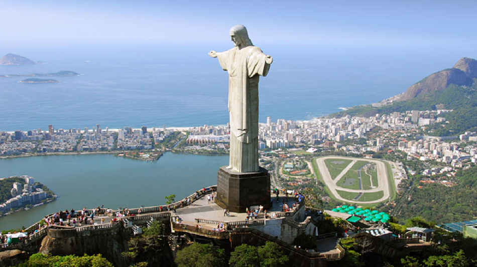
Brazil is synonymous with beauty, and it’s no surprise that the country is one of the top destinations for cosmetic surgery, particularly for body contouring procedures. Brazilian surgeons are internationally recognized for their expertise in body sculpting, including the iconic Brazilian Butt Lift (BBL), liposuction, and tummy tucks.
Cities like Rio de Janeiro and São Paulo offer cutting-edge medical facilities where patients can undergo transformative procedures while enjoying the vibrant energy and natural beauty of Brazil. Patients flock to Brazil not only for the expertise of its surgeons but also for the comprehensive care and luxurious recovery options available. From beachside recovery hotels to world-class aftercare facilities, Brazil provides a holistic approach to cosmetic surgery that combines medical excellence with comfort and luxury.
Brazil is the largest and most populous country in South America. It is the fifth largest country by geographical area, the fifth most populous country, and the fourth most populous democracy in the world. Its population comprises the majority of the world's Portuguese speakers. Bounded by the Atlantic Ocean on the east, Brazil has a coastline of over 7,491 kilometers (4,655 mi). It is bordered on the north by Venezuela, Suriname, Guyana and the overseas department of French Guiana; on the northwest by Colombia; on the west by Bolivia and Peru; on the southwest by Argentina and Paraguay and on the south by Uruguay.
Brazil was a colony of Portugal until its independence in 1822. Initially independent as the Empire of Brazil, the country has been a republic since 1889. The Constitution defines Brazil as a Federal Republic formed by the union of 26 States, the Federal District and the Municipalities.
Portuguese is the official language, Spanish, English, French are also widely spoken.
Brazil is the world's tenth largest economy at market exchange rates and the ninth largest in purchasing power. Economic reforms have given the country new international projection. It is a founding member of the United Nations, the Union of South American Nations, and the Community of Portuguese Language Countries. The Brazilian population is predominantly Roman Catholic, almost all Portuguese-speaking and multiethnic. Brazil is also home to a diversity of wildlife, natural environments, and extensive natural resources in a variety of protected habitats.
Brazil can be reached from most US cities within 8 to 12 hours. It's population is concentrated in the major cities of its coast. The urban sprawls of Rio de Janeiro and Sao Paulo dominate the southern coast. Further north, towns such as Salvador and Joao Pessoa retain the colonial atmosphere of the early Portuguese settlers. The great interior, much of which is covered by the rainforest basin of the Amazon, remains sparsely settled. The Amazon River Basin alone accounts for about 40% of Brazil's national territory.
More than 800 million people travel to Brazil each year, and since most major cities are on the coast, the country's best beaches are within easy reach. Visitors who want to experience unspoiled wildlife can find it in remote areas of the Amazon and the interior.
The legal system is based on the Federal Constitution, which was promulgated on 5 October 1988, and is the fundamental law of Brazil. All other legislation and court decisions must conform to its rules.
It spans three time zones and has a diverse topography, including hills, mountains, plains, highlands, and scrublands. Much of Brazil lies between 200 metres (660 ft) and 800 metres (2,600 ft) in elevation.
The climate of Brazil comprises a wide range of weather conditions across a large geographic scale and varied topography, but the largest part of the country is tropical.
Brazil hosts five major climatic subtypes: equatorial, tropical, semiarid, highland tropical, and temperate; ranging from equatorial rainforests in the north and semiarid deserts in the northeast, to temperate coniferous forests in the south and tropical savannas in central Brazil.
Religion is very diversified in Brazil; the constitution provides for freedom of religion, and the government generally respects this right in practice. The Roman Catholic Church is dominant, making Brazil the largest Catholic nation in the world.
Renowned surgeons known for their expertise in body contouring, including the Brazilian Butt Lift and liposuction.
Vibrant cultural experiences in Rio de Janeiro and São Paulo, where you can recover in style while exploring Brazil’s lively atmosphere.
Affordable, high-quality procedures that offer substantial savings compared to Western countries.
Brazil’s unique combination of cutting-edge medical care, cultural richness, and breathtaking landscapes makes it a top choice for patients seeking a body transformation.

Egypt is becoming a sought-after destination for cosmetic healthcare, known for offering high-quality treatments at competitive prices. With a growing number of internationally trained surgeons and modern medical facilities, Egypt provides a wide range of cosmetic procedures, from surgeries like liposuction and rhinoplasty to non-invasive treatments like Botox and fillers.
Patients benefit from advanced technologies, skilled professionals, and the opportunity to combine medical care with tourism in a country rich in history and culture. Egypt’s rise in medical tourism is driven by its commitment to affordability and excellence in cosmetic healthcare.
Egypt,officially the Arab Republic of Egypt, is a country mainly in North Africa, with the Sinai Peninsula forming a land bridge in Western Asia. Covering an area of about 1,010,000 square kilometers (390,000 sq mi), Egypt is bordered by the Mediterranean Sea to the north, the Gaza Strip and Israel to the northeast, the Red Sea to the east, Sudan to the south and Libya to the west.
Egypt is one of the most populous countries in Africa and the Middle East. The great majority of its estimated 76 million live near the banks of the Nile River, in an area of about 40,000 square kilometers (15,000 sq mi), where the only arable agricultural land is found. The large areas of the Sahara Desert are sparsely inhabited. About half of Egypt's residents live in urban areas, with the majority spread across the densely-populated centres of greater Cairo, Alexandria and other major cities in the Nile Delta.
Egypt is famous for its ancient civilization and some of the world's most famous monuments, including the Giza pyramid complex and its Great Sphinx. The southern city of Luxor contains numerous ancient artifacts, such as the Karnak Temple and the Valley of the Kings. Egypt is widely regarded as an important political and cultural nation of the Middle East.
Egypt possesses one of the most developed economies in the Middle East, with sectors such as tourism, agriculture, industry and service at almost equal rates in national production.Consequently, the Egyptian economy is rapidly developing, due in part to legislation aimed at luring investments, coupled with both internal and political stability, along with recent trade and market liberalization.
Geography
At 1,001,450 square kilometers (386,660 sq mi),Egypt is the world's 38th-largest country. In terms of land area, it is approximately the same size as all of Central America,twice the size of Spain,four times the size of the United Kingdom,and the combined size of the US states of Texas and California.
Nevertheless, due to the aridity of Egypt's climate, population centres are concentrated along the narrow Nile Valley and Delta, meaning that approximately 99% of the population uses only about 5.5% of the total land area.
Egypt is bordered by Libya to the west, Sudan to the south, and by the Gaza Strip and Israel to the east. Egypt's important role in geopolitics stems from its strategic position: a transcontinental nation, it possesses a land bridge (the Isthmus of Suez) between Africa and Asia, which in turn is traversed by a navigable waterway (the Suez Canal) that connects the Mediterranean Sea with the Indian Ocean via the Red Sea.
Apart from the Nile Valley, the majority of Egypt's landscape is a desert. The winds blowing can create sand dunes more than 100 feet (30 m) high. Egypt includes parts of the Sahara Desert and of the Libyan Desert. These deserts were referred to as the "red land" in ancient Egypt, and they protected the Kingdom of the Pharaohs from western threats.
Climate
Egypt does not receive much rainfall except in the winter months.South of Cairo, rainfall averages only around 2 to 5 mm (0.1 to 0.2 in) per year and at intervals of many years. On a very thin strip of the northern coast the rainfall can be as high as 410 mm (16 in),with most of the rainfall between October and March. Snow falls on Sinai's mountains and some of the north coastal cities such as Damietta, Baltim, Sidi Barrany, etc. and rarely in Alexandria, frost is also known in mid-Sinai and mid-Egypt.
Temperatures average between 80F (27C) and 90F (32 C) in summer, and up to 109 F (43 C) on the Red Sea coast. Temperatures average between 55 F (13 C) and 70 F (21 C) in winter. A steady wind from the northwest helps hold down the temperature near the Mediterranean coast. The Khamaseen is a wind that blows from the south in Egypt in spring, bringing sand and dust, and sometimes raises the temperature in the desert to more than 100 F (38 C).
Highly skilled surgeons and JCI-accredited hospitals offering advanced cosmetic surgery techniques.
Affordable procedures compared to Western countries, with significant cost savings.
A serene recovery experience in tropical resorts and wellness retreats in Phuket, Koh Samui, and beyond.
Egypt offers high-quality cosmetic treatments at affordable prices, with skilled, internationally trained surgeons and modern facilities. Patients can enjoy excellent care while exploring Egypt’s rich cultural heritage, making it a top destination for medical tourism.
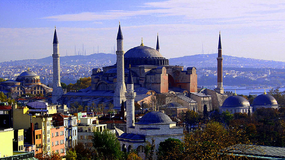
Turkey has earned its place as a leading destination for cosmetic surgery, particularly in cities like Istanbul. With its world-class clinics and highly skilled surgeons, Turkey is especially renowned for facial procedures like rhinoplasty, as well as hair transplants, body contouring, and breast surgeries. Istanbul, in particular, offers state-of-the-art medical facilities that attract patients from all over the globe.
Turkey’s affordability, combined with its rich history and cultural charm, makes it a standout destination. While you recover, you can explore the breathtaking sites of Istanbul, from the Hagia Sophia to the Bosphorus, or simply unwind in the luxurious comforts of a recovery hotel.
LOCATION & GEOGRAPHY:
Turkey geographical location has made it the land bridge between Europe and Asia for many thousands of years. Istanbul is the capital of Turkey, the other major cities are Ankara, Izmir, Bursa and Adana. In size, Turkey is larger than Texas. A good portion of the land in Turkey is covered by forest. Since 1924, Turkey has been a secular nation, with religion separate from government. The Republic of Turkey was founded on October 29, 1923, by Mustafa Kemal Ataturk, who led the Turkish troops to victory.
The Turkish language belongs to the Ural-Altaic group; it resembles most closely Finnish and Hungarian of the languages found in Europe. Turkish is written in the Latin alphabet, not in Arabic or in Cyrillic characters, and it is spoken not only in Turkey but also in a wide band of Turkic-speaking countries all across Central Asia.
Turkey has a widely varied geographical and climatic condition and hence is able to produce almost every type of fruit and vegetable. Turkey produces enough food and fiber to supply not only all of its more than 60 million people but also the people of Kuwait and Saudi Arabia and many of the people in Libya and Algeria.
Turkish is the native language of 90% of Turkey's population. There are about 70 languages and dialects spoken in Turkey including Circassian and Kurdish dialects, Arabic, Greek and Armenian.
Two bridges in Istanbul now connect Europe with Asia, and a third bridge is well along in the planning stage. The major trucking and tourist traffic from east to west and from west to east crosses those bridges.
Istanbul's Ataturk International Airport is the primary international gateway of Turkey. Ankara's Esenboga Airport handles a comparatively limited selection of international flights, and there are also direct charters to Mediterranean resort hot spots like Antalya in the peak summer and winter seasons.
Expert surgeons known for their proficiency in facial procedures such as rhinoplasty and facelifts.
Affordable cosmetic procedures that offer incredible value without compromising quality.
Cultural richness that allows you to explore ancient wonders and modern luxuries during your recovery.
Whether you’re recovering from surgery while cruising along the Bosphorus or taking in the beauty of the Blue Mosque, Turkey offers an experience that goes beyond medical care—it’s a cultural journey that enriches your entire transformation.
Traveling for cosmetic surgery is more than just a medical trip—it’s a life-enhancing experience that allows you to explore new cultures while achieving your aesthetic goals. At Best Cosmetic Hospitals, we are committed to helping you make the most of your journey by connecting you with top-tier hospitals and experienced surgeons across the world.
When planning your cosmetic surgery abroad, consider the following:
Medical Tourism Packages: Many hospitals offer comprehensive packages that include surgery, accommodation, transportation, and post-operative care. These packages are designed to ensure a seamless and stress-free experience.
Recovery Planning: Choose a destination where you can relax and enjoy your recovery in a beautiful, peaceful setting. Whether it’s a beachside retreat or a luxury city hotel, planning for comfort during recovery is essential.
Explore Local Culture: While you’re in a new country, take time to explore local attractions and immerse yourself in the culture. From historical landmarks to natural wonders, each destination offers a unique experience that enriches your journey.
At Best Cosmetic Hospitals, we are dedicated to helping you achieve your aesthetic goals while exploring the world’s most stunning destinations. Whether you’re looking for a rejuvenating facelift in Turkey, a body sculpting procedure in Brazil, or a non-invasive treatment in Thailand, our network of top surgeons and hospitals will ensure that your experience is both successful and memorable.
Explore our curated list of destinations and schedule your consultation today to begin your transformative journey.